 |
 |
 |
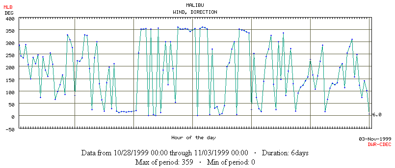 |
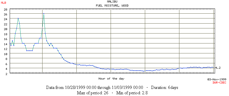
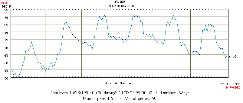
The panels above show weather data from a coastal automated weather station (part of the RAWS network), capturing conditions that are representative of Santa Ana winds. Of the 6 days shown in the graphs above, days 2-4 were separated from the "normal" weather conditions data for simulations with HFire. Criteria for being a Santa Ana "event" are relative to average conditions for this coastal location, including higher wind speeds (top panel), lower humidity and fuel moistures (2nd panel), higher temperatures (3rd panel), and offshore wind direction (bottom panel). Santa Anas can vary in their duration and intensity, and some regions experience much more extreme fire weather conditions than those recorded in this event at this location.
|
Last updated: <July 22, 2002>
|