|
HFire has several input parameters that need to be specified (e.g., winds, topography and fuels characteristics), even if one is simulating a single fire event. For background on the variables influencing fire behavior, a good place to start is the Southern California Wildfire Hazard Center (SCWHC).
Modeling the fire regime of a region requires many additional parameters (e.g., characteristics of suppression, weather events, ignitions, and vegetation regrowth), so that one can simulate both stochastic and deterministic aspects of a changing environment over long periods of time. A discussion of parameters and validation of baseline simulation runs will be given in the following pages. Refer to HFire's online documentation for complete model description and more about individual input parameters for HFire.
The following site-specific information was gathered for SAMO and formatted as input to HFire:
| Topography: | slope and aspect generated from a digital elevation model |
| Fuels: | vegetation maps; details of post-fire succession; moisture trends |
| Weather: | wind speed and direction, both normal and extreme conditions; humidities |
| Ignitions: | spatial and temporal probabilities |
| Suppression: | threshold rates of spread for extinction |
To simulate fire regimes in SAMO, Hfire was run at a 100-m resolution for cell size for all spatially explicit input data. The "fire season" extended from July 1 to November 30. Each run was initialized with an age surface map of vegetation as of 1998, based on the actual fire history of the study area. To eliminate potential sensitivity to initial conditions, simulation scenarios were run for 600 yr, and the first 100 yr were discarded before fire regimes were analyzed.
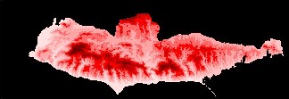
Slope (i.e., hillside steepness) and aspect (i.e., the compass direction a hillside faces) are needed to calculate the speed and direction of fire spread. Maps of slope and aspect were generated from a digital elevation model (DEM), shown below.
|
At right is a digital elevation model for SAMO
(darker reds are higher).
|
Similar to the effect of wind on flames, fire will generally spread faster up steeper hillsides. Conversely, fire will propagate more slowly in a downhill direction, to the point of extinction if not driven forward by strong enough winds.
|
|
Fire spread models utilize maps of fuels characteristics, which are generated from the types and ages of vegetation. Fuels characteristics, such as the amounts of live and dead biomass in different stem size classes, surface area-to-volume ratios, and heat contents during combustion, can be described through standardized "fuel models." Details of how fuel models were derived for SAMO can be found on the fuels pages of SCWHC.
|
At right is a map of fuel models for the 1999
SAMO landscape.
|
The reddish colors represent a custom fuel model for urban-wildland interface vegetation (e.g., domestic landscaping of the area), and the other colors represent different vegetation types in various stages of post-fire succession.
At a given point in time, a patch of vegetation on the landscape is assigned to a specific fuel model, depending on the plant community at that location and the time elapsed since the last fire. The development sequence for fuels is generally characterized by being less flammable in early years and by accumulating biomass (i.e., more and heavier material) over time. Additional information on the temporal progression of fuels for HFire can be found here.
Note that we have changed the fuel model for the first few years of growth in shrubland vegetation from "short grass" (NFFL #1) to that for "low brush" (NFFL #5), because very young stands of shrublands were burning far too easily in preliminary runs. In addition to being a relevant model for early successional species in many shrubland communities, NFFL #5 results in fire shapes and sizes that are more realistic than others we tested.
We have also set average live fuel moistures at the moderate levels of 85% for woody material and 105% for herbaceous material (by dry weight; standard deviation of 5% between years). These levels are fixed throughout a given fire season, rather than starting high in the spring and drying out as summer progresses. Although fixing live fuel moistures is unrealistic, doing so eliminates one of the many sources of variation in our simulation environment, allowing us to isolate the effects of variation in other selected parameters. Fine-tuning fuel models, changing successional development paths, and including seasonal dry-down are all important areas for future work.
|
|
Weather can have a strong effect on fire behavior, especially during extreme conditions. To simulate representative weather in the study area, we gathered hourly observations from two nearby stations, Malibu and Cheesebro, for two full fire seasons (1998 and 1999). The normal daytime pattern for the study area is one of relatively cool, moist onshore breezes from the ocean (out of the south-west). There is a predictable switch in wind direction each evening, turning offshore (out of the north-east) and remaining from this direction until it switches again at mid-morning on the next day.
In the SAMO region, Santa Ana winds occur several times each year and greatly increase the chances for an ignition to become a large and intense wildfire. For this reason, we have separated Santa Anas from "normal" weather conditions, so we can vary the number and duration of extreme fire weather events during simulation of fire regimes. Santa Ana events are characterized by strong winds, high temperatures, and very low humidities.
|
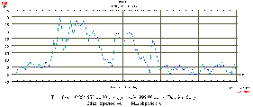
Click on the image at right to see characteristics
of a typical Santa Ana event.
|
After accounting for missing data and removing Santa Ana days, there are ~500 days of hourly observations for "normal" weather; the extreme fire weather database is ~5% this size, consisting of 28 days of hourly observations.
|
|
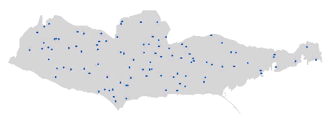
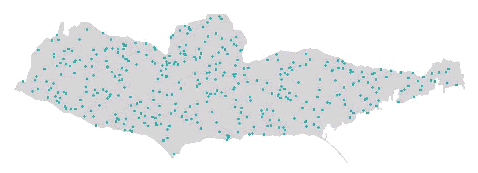
Although HFire allows one to specify ignition locations, we use spatially homogeneous ignition probabilities. Ignitions are temporally driven by the annual average frequency, another user-specified parameter. For example, here are "ignition histories" (50 yr) for different frequency settings:
 |
Ignition frequency of 2 per year. |
 |
Ignition frequency of 8 per year.
|
|
|
Fires can stop spreading at either natural barriers (e.g., ridgelines) or those created by humans (e.g., roads and firebreaks). Fires may also go out when they encounter conditions that slow them to the point of extinction (e.g., moist or sparse vegetation). "Suppression" in our scenarios is modeled through a simple extinction rate of spread threshold. Fire in a given cell must therefore be traveling above the specified rate to spread into neighboring cells and expand the flaming front of the fire, or it "goes out" in that cell. We explored rate thresholds ranging from ~0.02 to 0.05 m/s.
|
|
|
|
Last updated: <February, 2003>
|


